A model can tell us a lot, if we are clear about the question it was built to answer.
That is especially important when discussing the recently completed Land Use Impacts Modeling and Assessment, or LIMA, study of the Occoquan Watershed.
This work also has a Prince William County origin.
In 2022, our Board asked the Northern Virginia Regional Commission to use the Occoquan Watershed and Reservoir Model to examine how development in Prince William could affect nutrient and sediment loading within the watershed. Regional water experts ultimately recommended broadening that work into a 2040 assessment covering projected future land use across the entire Occoquan basin.
That became LIMA.
Researchers with Virginia Tech’s Occoquan Watershed Monitoring Laboratory examined how projected land-use change, increasing impervious surface, future climate conditions and selected changes in treated-water return flows could affect streamflow and selected water-quality conditions through 2040.
And the findings deserve attention.
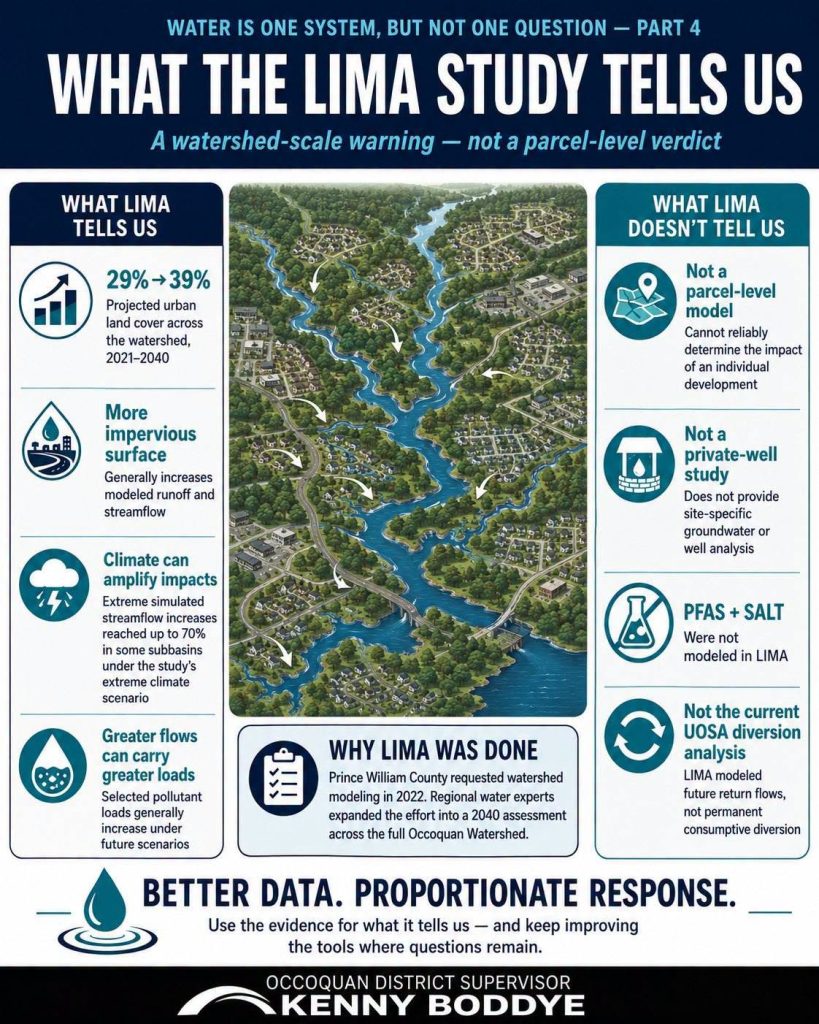
Across the watershed, urban land cover is projected to increase from about 29% in 2021 to 39% by 2040.
When researchers modeled land-use change alone, greater impervious surface generally increased simulated streamflow. Climate effects were substantially larger: under the study’s more extreme future climate scenario, some subbasins experienced modeled increases in extreme streamflow of as much as 70%.
The study also generally found that greater flows can mean greater annual loads of selected pollutants moving through the watershed, particularly when land-use and climate effects are combined.
In other words: land use matters, and climate can amplify those impacts.
But LIMA was also testing something else important: the model itself.
The study identified significant limitations in the existing, or “legacy,” Occoquan model. Because changes have to be aggregated across relatively broad areas, it cannot reliably tell us what will happen at every individual parcel, small stream or highly localized area.
It also did not model PFAS or salt, and it does not provide a site-specific analysis of private wells or localized groundwater conditions. A newer, higher-resolution Occoquan Watershed Modeling Framework is now being developed to improve future analysis.
There is another timely distinction worth making.
LIMA included a scenario involving increased future UOSA return flows in Lower Bull Run. It was not designed to evaluate the current regional proposal to permanently divert some of those return flows for consumptive reuse. That is a different water-management question, and one I’ll be discussing separately as the Board considers my upcoming Occoquan Reservoir resolution.
So what should we take from LIMA? I think the answer is straightforward:
LIMA gives us a credible watershed-scale warning, not a parcel-level verdict.
It would be wrong to dismiss the study because the model has limitations. It would also be wrong to stretch its findings into conclusions the model cannot support.
Good policy requires both taking the evidence seriously and understanding its boundaries.
Better data. Proportionate response.
That remains the principle guiding this series and, I believe, the right approach to protecting the Occoquan as our region continues to grow.
To read more, view the September 15, 2026 work session packet, which includes details on the LIMA report.
Read my resolution to reaffirm commitment to protect the Occoquan Reservoir and oppose diversions from the Occoquan Watershed for consumptive reuse.